

Connecting GIS and Public Health: 2016 Regional Health Data Mapping Workshop
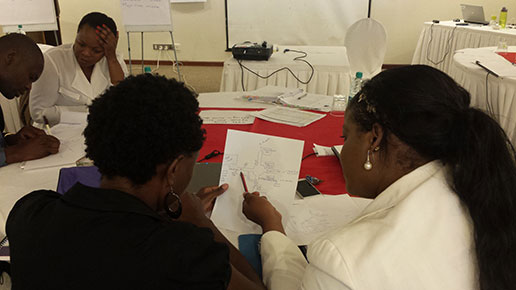
Participants from Kenya and Zambia discussing their hand drawn maps.
In August, The DHS Program Geospatial team is hosting this year’s Regional Health Data Mapping Workshop in Accra, Ghana. The workshop will focus on the application of Geographic Information System (GIS) in public health, specifically using maps for better program and policy decisionmaking. This will be a basic workshop that introduces participants to data concepts including management and cleaning of data in Microsoft Excel, introduction to GIS concepts (including GPS data collection), using maps as part of the decisionmaking process, and hands-on introduction to QGIS, an open source GIS software package.

Participant from Zambia working on a 3-D data visualization activity.
We are excited to share mapmaking skills with a new group of participants! From finalizing the venue, selecting participants, and preparing the curriculum, we are working hard to organize everything for the workshop. Selecting the workshop participants was the most difficult part of the process so far but in the end, 20 participants were accepted out of the 600 that applied!
In 2015, we hosted a similar workshop in East Africa and also had over 600 applicants for 20 spots. We believe this continued show of interest indicates how important a skill mapmaking is, and the great need for this skill in the health sector across the world. The workshop curriculum facilitates learning these skills via guided activities, group work, and hands-on software activities where participants get to show off their hard work!
This year’s workshop specifically targets West African countries (Burkina Faso, Ghana, Liberia, Mali, Nigeria, Senegal, Sierra Leone, and Togo) and two others, Chad and Egypt, where The DHS Program has recently done or will soon be doing a household survey.
Applicants didn’t need to be experts in GIS to be selected – in fact, we preferred that they weren’t! We wanted applicants with little to no GIS experience, though certainly sought those with an interest in learning and strong data skills. In our selection, we focused on individuals with current positions within government ministries, development partners, and local universities. We hope that participants use their newfound health mapping skills to improve the use of DHS data and other data for decisionmaking in their home countries, and also to teach others in their home offices.
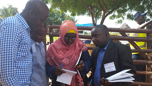
Participants from Tanzania practicing GPS data collection skills.
Even individuals who do not attend the workshop can still benefit from the learning of those who do and also from self-taught learning through our many mapmaking and data analysis-related resources at The DHS Program. These include the Spatial Data Repository, STATcompiler, Spatial Analysis Reports, and video tutorials.
I will be co-facilitating the workshop, so stay tuned for an upcoming blog post on how it all went!

Good Afternoon,
I’m from Niger and i want to know if we have the possibility to submit our candidature to participate to the workshop?
Applications are no longer being accepted for this workshop, but we encourage you to follow us for more opportunities in the future.
I understand the applications submitted for this was more than expectation. Owing to the growing demand, what is @The DHS Program doing to expand this indispensable initiative?
When will be the next workshop. I am very much interested to attend.