Spatial Anonymization in Household Surveys

Location is an important factor in population and health outcomes. Knowing the geospatial location of household survey clusters allows researchers to analyze the impact of location on peoples’ health, nutrition, and access to health care services. Geospatial data provide a clearer picture of where progress towards the Sustainable Development Goals is and is not being made at subnational levels.
The United Nations’ Inter-Secretariat Working Group on Household Surveys (ISWGHS) was convened to identify priority areas for household surveys to meet new data demands and increase their impact on policy and research over the next decade of the 2030 Agenda for Sustainable Development. Under the ISWGHS, The DHS Program and the World Bank co-led a task force on Spatial Anonymization of Public-Use Household Survey Datasets.
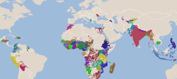
The DHS Program has collected GPS coordinates for household survey clusters since 1996. To ensure respondent confidentiality and prevent positive identification (disclosure) of respondent locations, the GPS position of each urban cluster is displaced by up to two kilometers and up to 5-10 kilometers for rural clusters. This method of geomasking coordinates developed by The DHS Program is straightforward and has been widely accepted by analysts using DHS geospatial data. Nonetheless, there are legitimate concerns that urban points may be overly displaced, reducing the analytical usefulness of the geospatial data, and that some rural points may not be adequately displaced to ensure respondent confidentiality. In response, the spatial anonymization task force convened to explore more sophisticated methods of anonymizing geospatial data.
The task force developed and tested new population-based displacement tools on multiple DHS survey datasets. These tools use an area’s population to determine the minimum distance a cluster’s GPS position must be displaced. These new methods show promise over current spatial anonymization methods to better protect survey respondents while minimizing any adverse impact on analysis and continue to be explored using DHS datasets.
The task force also outlines immediate steps that can be taken to protect respondents. “Even without switching to a new population-based approach [to anonymize geospatial data], we should take steps to verify that we are within an acceptable level of disclosure risk and that our current anonymization objectives are being achieved,” explains Trinadh Dontamsetti, Lead, Geospatial Research. Standards in data protection and security have evolved—the European Union General Data Protection Regulation requires that personal data, including location data, be safeguarded. The task force recommends assessing the risk of disclosure. By quantifying and measuring spatial disclosure risk, the risk can be managed.
Read the “Spatial Anonymization” report for more from the Spatial Anonymization of Public-Use Household Survey Datasets task force. This report was also discussed by stakeholders to prepare a forthcoming paper on “Positioning Household Surveys for the Next Decade.” Both papers will be presented as part of the 52nd Session of the United Nations Statistical Commission: Better Data Better Lives on March 1-3 and 5, 2021.

